Shopping cart

Your cart is currently empty

Product image slideshow Items

  • Trail Ventures Trail Ventures PoMo to PoCo Map

Trail Ventures PoMo to PoCo Map

Article number: P-20551
C$18.95
Excl. tax

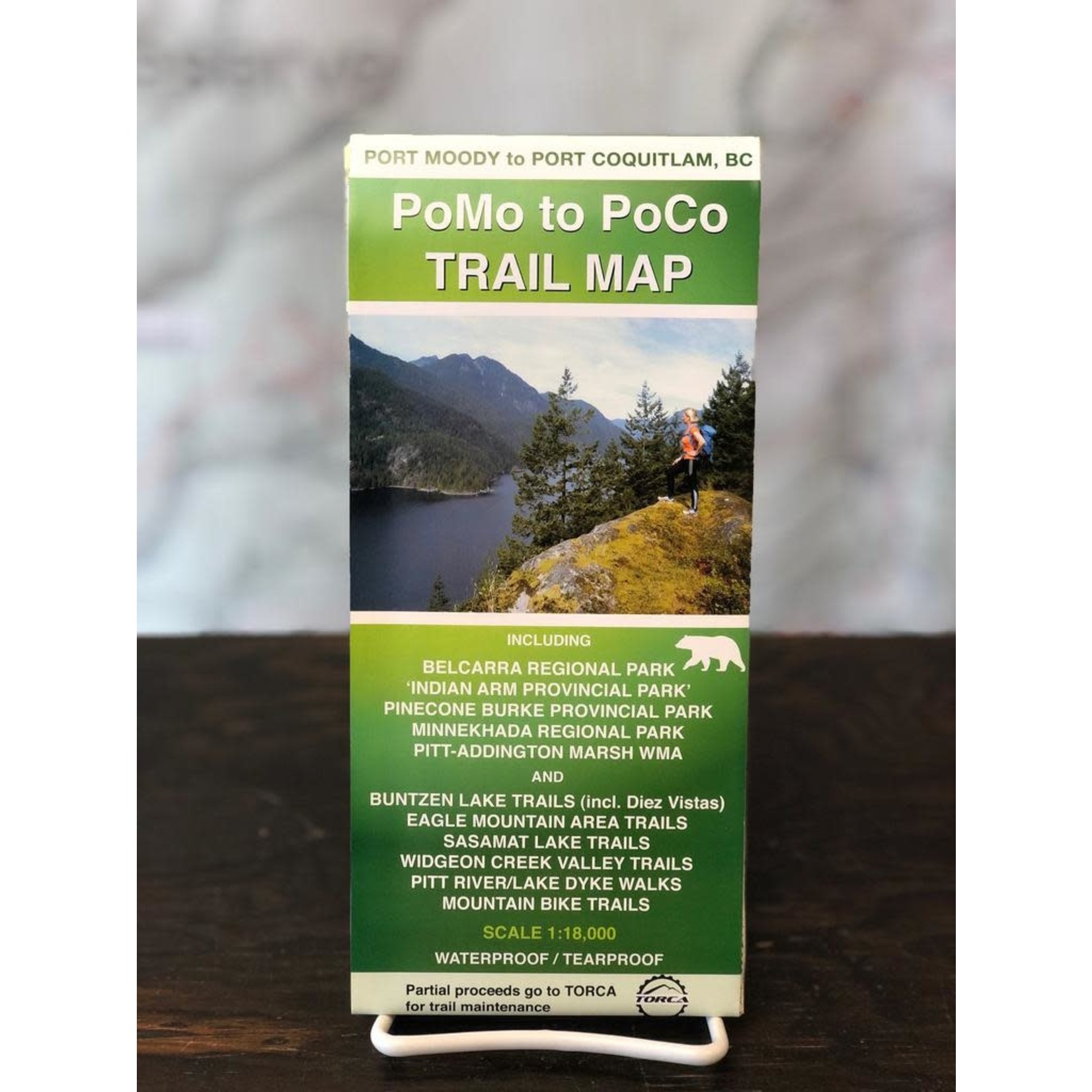
NEW! Accurate and detailed trail map for the Port Moody, Coquitlam, Port Coquitlam, Widgeon Creek Valley, Buntzen Lake, and Pitt River and Pitt Lake areas.

This map is made for walking, hiking, mountain biking, cycling, mountaineering, camping and

In stock (1)


  • This detailed, accurate Coquitlam trail map covers recreational areas in town, residential areas and the entire backcountry
  • Includes Belcarra Regional Park, ‘Indian Arm Provincial Park’, Pinecone Burke Provincial Park, Minnekhada Regional Park, Widgeon Marsh Regional Park Reserve & Pitt-Addington Marsh WMA
  • Rocky Point Park, Town Centre Park, Bert Flinn Park, Coquitlam River Park, Ridge Park, Eagle Mountain Park, North Hoy Creek Park, Noons Creek Park & many more
  • Buntzen Lake trails (including Diez Vistas Trail), Eagle Mountain area trails & Sasamat Lake Trails
  • Eagle and Burke mountain bike trail networks, cycling routes & more
  • Widgeon Slough paddling route, Widgeon Creek Valley trails & Pitt River/Pitt Lake dyke walks
  • Includes the Coquitlam Crunch Trail & the entire Burke-Widgeon Connector Mountaineering Route
  • This double-sided map shows all backroads and trails for the entire map area
  • Distances along main trails are displayed
  • Waterproof & tear resistant – if cared for properly, this map will last for many years
  • 1:18,000 scale main maps with one 1:20,000 map
  • Locator map
  • All Skytrain stations, streets and roads to show access to all parks and trails
  • Coquitlam trail map area extends from Indian Arm area to Pitt Meadows (W to E) and Lougheed Hwy to Coquitlam Lake/Widgeon Lake (S to N)